Water level and rainfall monitoring to detect trends, trigger alerts, and coordinate preventive responses.
Operational challenge
Heavy rain and rising water can evolve quickly, with critical points far from operations teams and limited real-time visibility for preventive decisions.
Horus response
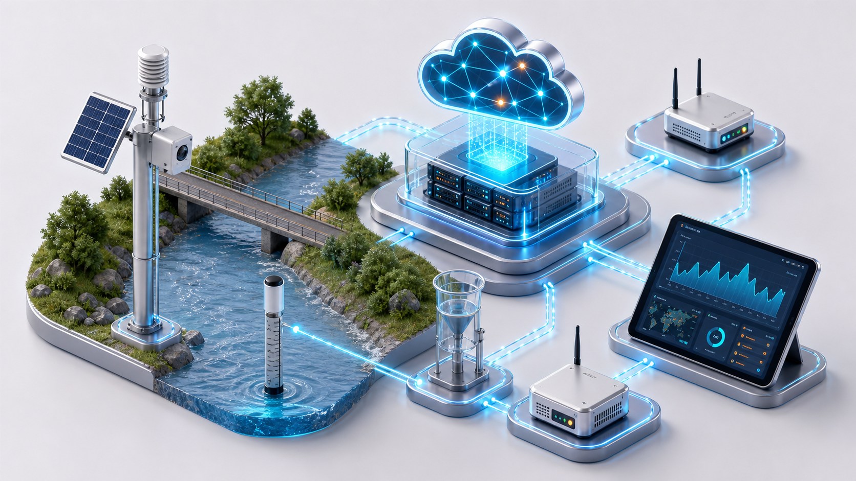
Horus connects rain gauges, water level sensors, cameras, and weather stations to track risk evolution and notify the right people.
How it works
Field devices send periodic measurements. The platform compares water levels, rainfall, and operational history to detect trends, generate early alerts, and activate prevention scenarios.
Deployment model
Autonomous field sensors connected through IP, LoRa, SMS, or local gateways to Horus Cloud.
Key benefits
- Disaster prevention
- Risk and damage reduction
- Fast, coordinated response
- Protection of lives and assets
Typical applications
Overview
Early flood warning turns scattered measurements into a continuous view of risk. Horus brings together water level, rainfall, images, and weather variables so teams can anticipate, communicate, and act before an event escalates.
Included capabilities
- Real-time water level and rainfall monitoring
- Detection of trends and accelerated changes
- Notification to responsible teams, communities, and emergency groups
- Activation of sirens, protocols, and prevention scenarios
Operational impact
This is a natural fit for territories that need continuous monitoring in areas with limited connectivity, variable power infrastructure, and multiple actors involved in the response.